Home » Case 1: Medmerry Managed Coastal Realignment, Selsey, UK
Nature-based Solutions for Major Societal Challenges
Case 1: Medmerry Managed Coastal Realignment, Selsey, UK
#Climate change #Disaster risk #Ecological restoration #Ecological engineering #Ecosystem-based disaster risk reduction #Ecosystem-based adaptation #Natural infrastructure #Area-based conservation approaches
The Medmerry managed realignment project in Selsey, UK was a large-scale flood risk reduction project led by the UK Environment Agency to realign coastal defenses inland, enhancing flood protection significantly and at the same time creating wildlife habitats and boosting tourism and recreation. Constructed work started in 2011 and completed in 2013. The project demonstrates success and adherence with the NbS-GS (Meyer & Hessenberger, 2022).
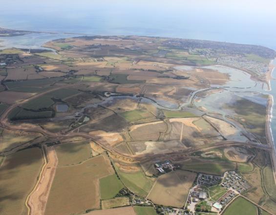
Image from Medmerry Managed Coastal Realignment, by UK Environment Agency, 2022, PANORAMA
(https://panorama.solutions/en/solution/medmerry-managed-coastal-realignment). CC BY-NC 4.0
NbS-GS Criterion 1: NbS effectively address societal challenges
Medmerry, located on the south coast of England, had long been facing the problem of flooding from the sea. There was a narrow shingle embankment to protect the area, but it could only hold back very small coastal storms. Flooding became more frequent under climate change and sea level rise, threatening life and causing property and infrastructure damage as well as habitat loss (Meyer & Hessenberger, 2022).
The serious flood in 2008 led to economic damage of over GBP 5 million and required evacuation. Flood risk reduction was prioritised as the main societal challenge in a vision exercise for Medmerry conducted in 2009 involving local communities, government representatives and statutory organisations. The flooding challenge was also confirmed by evidence from environmental assessment data of flood events, flood risk mapping and modelling (Gray, 2022; Meyer & Hessenberger, 2022).
The project built 7 km of new sea walls up to 2 km inland from the coast and then made a 110 m wide breach of the existing shingle bank, allowing tidal water to flow in, creating 183 ha of new intertidal habitat area that can absorb the energy of the waves. The new defences can withstand a one-in-a-thousand-year flood (McGrath, 2013). The project has reduced flood risk from annual occurrence to a probability of less than 0.5% per year, protecting over 300 residential and commercial properties as well as infrastructure serving 5,000 households (Gray, 2022).
NbS-GS Criterion 2: NbS incorporate an ecological, economic, social and cultural systems perspective
A full EIA was conducted during the project planning phase, assessing 200 miles of the UK coast to identify the most suitable NbS while considering landscape, community, and habitat impacts. Biodiversity protection was given importance, so biodiversity risks were identified and mitigation measures were taken (e.g., water voles were translocated before the works started). Business opportunities were, however, not considered in depth at the early stage (Gray, 2022; Meyer & Hessenberger, 2022).
The project attracted collaborative effort in coastline protection from the private sector. There was a holiday park next to the project site, but the realignment scheme could not be extended to protect it. However, during the project period, the park self-funded a complementary scheme, which was completed in 2013 (Gray et al., 2016).
NbS-GS Criterion 3: NbS result in positive change in the state of biodiversity and enhanced ecosystem integrity, including connectivity
Biodiversity baseline data was collected and benchmarks established during a five-year monitoring period. Ongoing monitoring is done by the Royal Society for the Protection of Birds, which has managed the area as a nature reserve since 2013 under a 99-year lease. The monitoring included surveys of birds, invertebrates, reptiles, and fish, as well as vegetation and habitat mapping using satellite imagery, among other methods (Gray, 2022).
The project has created around 300 ha of wildlife habitats including a vast intertidal wetland that sequesters carbon. Monitoring results indicate an increase of saltmarsh plants, breeding birds, invertebrates, reptiles, and fish, etc. The project also enhanced other ecosystem services including climate regulation, erosion regulation, as well as water purification and waste treatment (Gray, 2022).
NbS-GS Criterion 4: NbS are financially feasible and economically justified
At the planning stage, a cost-effectiveness assessment and an options appraisal were conducted, evaluating and comparing the proposed options’ costs and benefits, technical viability and environmental outcomes. This enabled the project team to choose the best option with the greatest environmental, social and economic values against alternatives.
The project area attracts 22,000 visitors annually. Local businesses benefited substantially from the increased recreational and touristic attractiveness brought by the project. Estimated economic benefits of around GBP 91.7 million (over three folds of the project cost of GBP 28 million) were derived from the NbS, including environmental benefits of GBP 13.5 million. An estimated GBP 168 million in economic benefits are expected over 100 years (Gray, 2022; Meyer & Hessenberger, 2022).
NbS-GS Criterion 5: NbS are based on inclusive, transparent and empowering governance processes
A key strength of the project is its emphasis on stakeholder engagement in all phases. A stakeholder analysis was done, and a stakeholder engagement plan was developed. Project information was proactively provided, and community views were sought (Gray, 2022).
The community was initially concerned of the landscape change, worried about moving the sea closer or losing countryside. The UK Environment Agency therefore formed the Medmerry Stakeholder Advisory Group made up of representatives from stakeholders and local community groups, including Parish Councils, affected residents, and local businesses. The Advisory group met regularly to discuss concerns and helped shape the project design. Community engagement gained widespread support for the intervention (Gray, 2022; Meyer & Hessenberger, 2022)
In addition, there was a complaint mechanism that allows affected individuals to express concerns via an independent ombudsman (Meyer & Hessenberger, 2022).
NbS-GS Criterion 6: NbS seek to equitably reconcile the achievement of their primary goal(s) with any intended and unintended impacts on the continued provision of multiple benefits
While flood risk reduction was the top priority, the project site, with its environmental and cultural values, makes habitat and archaeological conservation important. A separate Habitat Creation Working Group (including Natural England, Royal Society for the Protection of Birds, local wildlife groups, academics, local environmental officers and consultant staff) was established to advise the core project team on biodiversity issues. The Royal Society for the Protection of Birds was engaged to help with managing construction during breeding times. Water voles were translocated. Archaeological findings were preserved in collaboration with the Centre for Applied Archaeology at the University College London (Gray et al., 2016).
Community engagement was an essential part of the project, ensuring the local concerns were identified and addressed. The local communities worried about whether the project would lead to a loss of recreation opportunities, hinder accessibility to the coast, and negatively impact the local economy (Pearce, et al., 2012). These were being considered in the project design. Public access and recreational facilities such as cycle paths and bridleway were created while balancing recreation with conservation. The increased recreational attractiveness helped draw tourists and greatly benefited local businesses (Gray, 2022; Meyer & Hessenberger, 2022).
NbS-GS Criterion 7: NbS are managed adaptively, based on evidence
Expected benefits documented and baselines established at the early stage of the project informed the ongoing monitoring of impacts. Annual reports with findings and lessons learned summarised were shared and discussed with local stakeholders, relevant experts, and risk management authorities. Necessary adjustments were made to the project. For example, local community engagement approach was adapted based on early experiences and project challenges encountered (Gray, 2022).
NbS-GS Criterion 8: NbS contribute to the enhancement of the enabling conditions for their implementation, sustainability and mainstreaming
Lessons learned were documented in annual reports. The success of the managed coastal realignment project informed the design and planning of similar projects in the UK and increased the focus on NbS nationally (Gray, 2022).
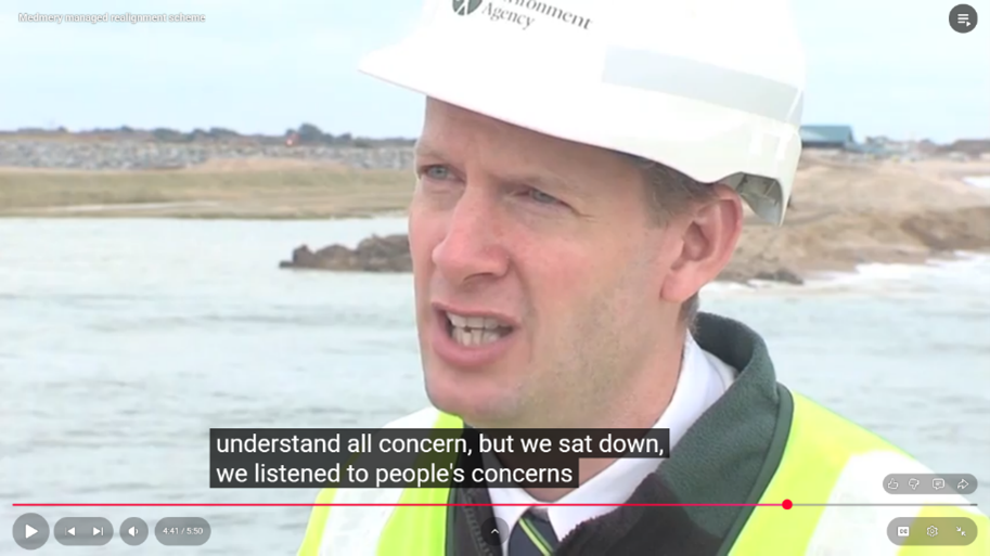
Environment Agency. (2013, November 1). Medmerry managed realignment scheme [Video]. YouTube.
https://www.youtube.com/watch?v=x7jemyJujg8&list=UU8XLubOua8P9B1hT0Qb5Tbg
Continue to 'Case 2: ‘Qiandao Lake Water Fund’ Programme in Hangzhou, China'
© 2026 Centre for Civil Society and Governance at The University of Hong Kong
Except where otherwise noted, contents of this e-study is licensed under a Creative Commons Attribution-NonCommercial-ShareAlike 4.0 License.
![]()